 Catàleg local de Mallorca
Area management/restriction/regulation zones and reporting units
Type of resources
Available actions
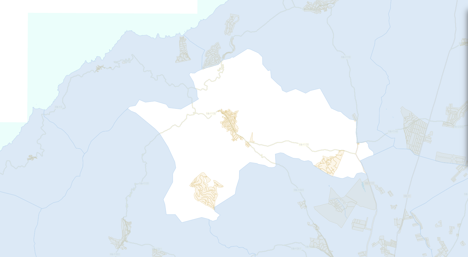
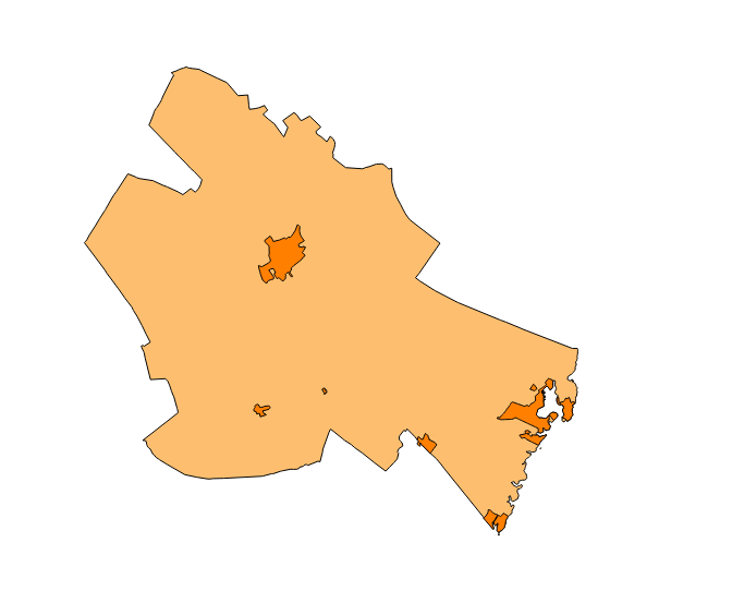
Municipios
INSPIRE themes
Keywords
Contact for the resource
Provided by
Years
Formats
Representation types
Service types
Scale
-
Data set containing the management areas of the municipality of Algaida. The cartography was taken from the Algaida Subsidiary Standards of 2005. The ForestManagementArea layer is a polygon layer and contains managed, restricted, or regulated forest areas that follow the INSPIRE data model. Scale 1: 5,000. The reference system: ETRS89. Projection system: UTM zone 31. Storage format: PostgreSQL.
-
Data set containing the management areas of the municipality of Muro. The cartography was taken from the 2003 Revisión of the Muro PGOU. The AM.ForestManagementArea layer is a polygon layer and contains managed, restricted, or regulated forest areas that follow the INSPIRE data model. Scale 1: 5,000. The reference system: ETRS89. Projection system: UTM zone 31. Storage format: PostgreSQL.
-
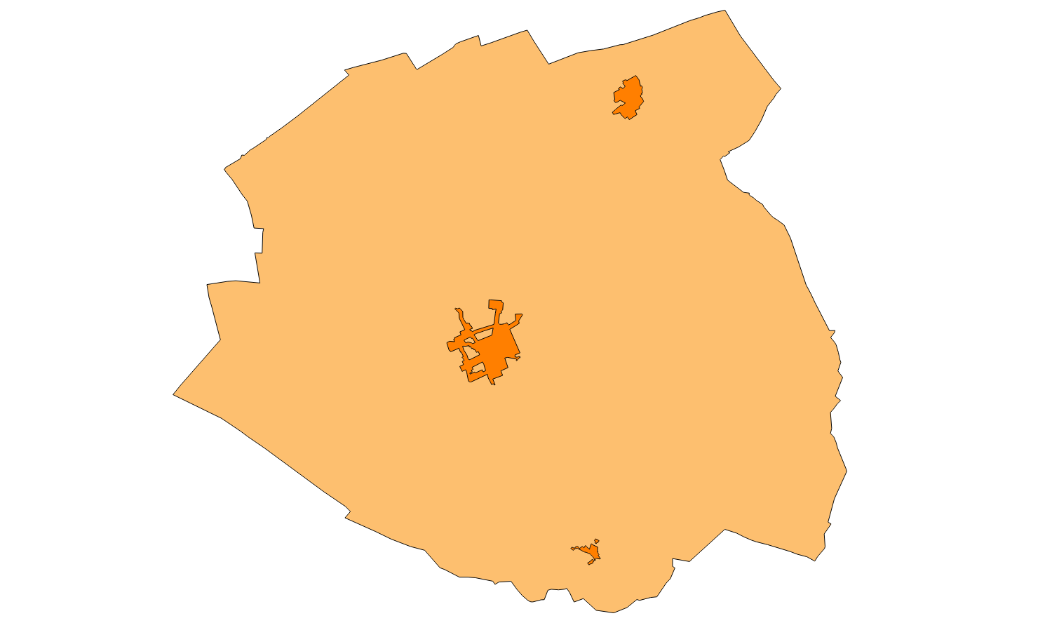
Data set containing the management areas of the municipality of Binissalem. The cartography was taken from the 2008 Binissalem Subsidiary Rules. The ForestManagementArea layer is a polygon layer and contains managed, restricted or regulated forest areas that follow the INSPIRE data model. The FloodUnitOfManagement layer is a polygon layer and contains flood risk areas that follow the INSPIRE data model. Scale 1:5,000. The reference system: ETRS89. Projection system: UTM spindle 31. Storage format: PostgreSQL.
-
Data set containing the management areas of the municipality of Llubí. The cartography was taken from the Llubí Subsidiary Standards of 2002. The AM.ForestManagementArea layer is a polygon layer and contains managed, restricted, or regulated forest areas that follow the INSPIRE data model. Scale 1: 5,000. The reference system: ETRS89. Projection system: UTM zone 31. Storage format: PostgreSQL.
-
Data set containing the management areas of the municipality of Esporles. The cartography was taken from the Esporles Subsidiary Standards of 2001. The AD.Addresses layer is a polygon layer and contains managed, restricted, or regulated forest areas and flood zones that follow the INSPIRE data model. Scale 1: 5,000. The reference system: ETRS89. Projection system: UTM zone 31. Storage format: PostgreSQL.
-
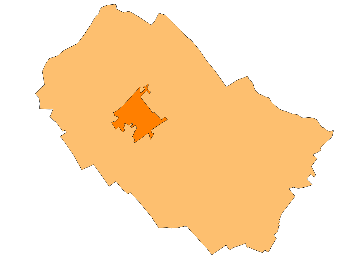
Data set containing the management areas of the municipality of Campanet. The cartography was extracted from the Revision of the Subisidàrias Norms of Campanet of 2003 referring to rustic land. The AM.ForestManagementArea layer is a polygon layer and contains managed, restricted, or regulated forest areas that follow the INSPIRE data model. Scale 1: 5,000. The reference system: ETRS89. Projection system: UTM zone 31. Storage format: PostgreSQL.
-
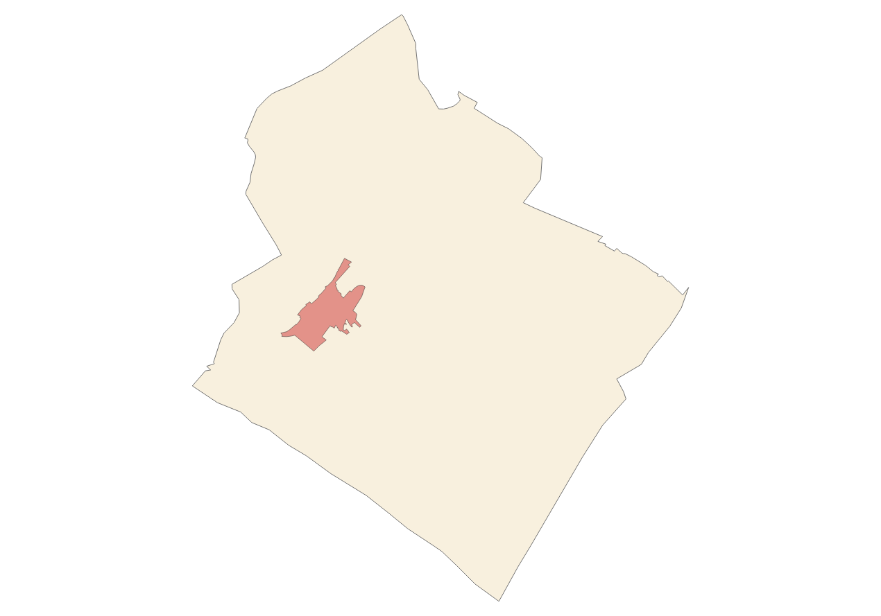
Data set containing the management areas of the municipality of Felanitx. The cartography was extracted from the modification of the PGOU in Felanitx on rustic land in 2002. The AM.ForestManagementArea layer is a polygon layer and contains managed, restricted, or regulated forest areas that follow the INSPIRE data model. Scale 1: 5,000. The reference system: ETRS89. Projection system: UTM zone 31. Storage format: PostgreSQL.
-
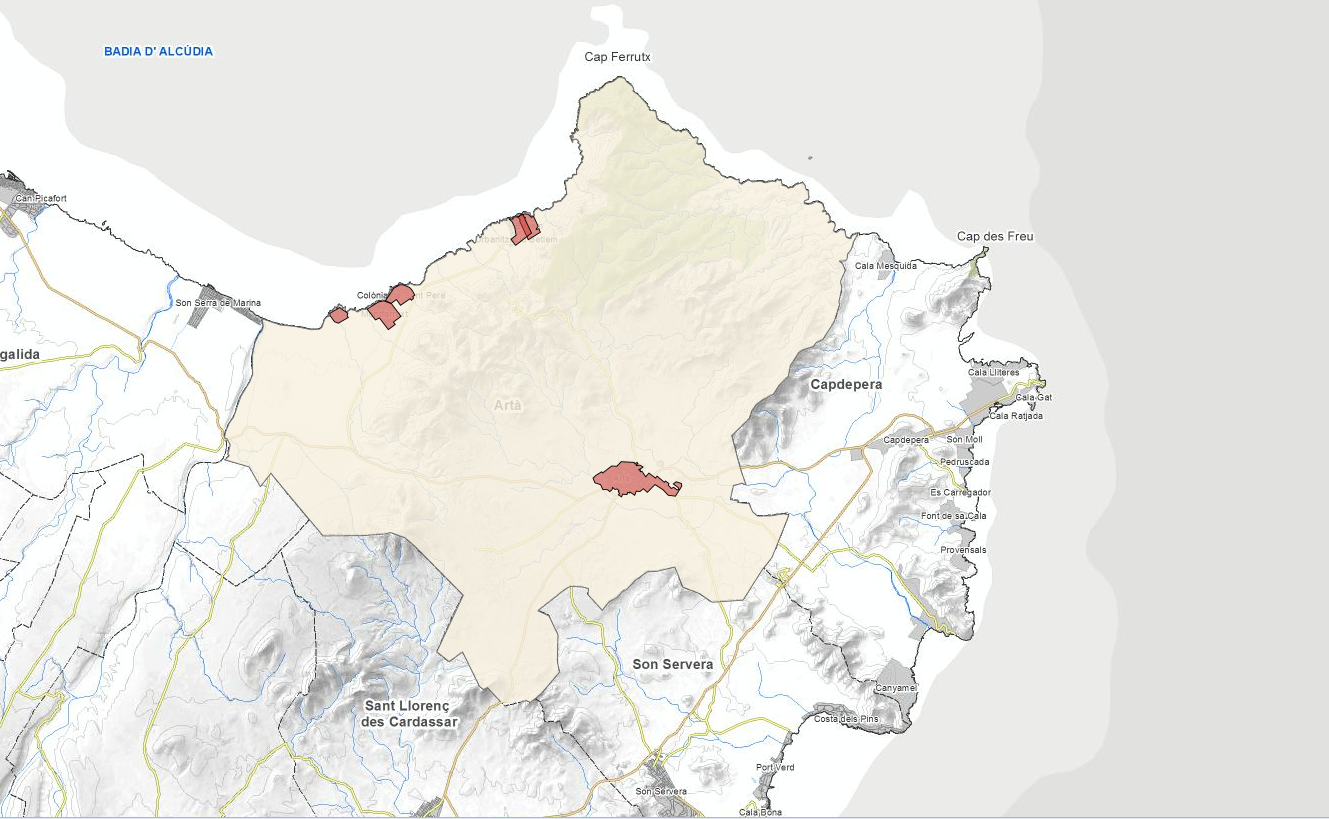
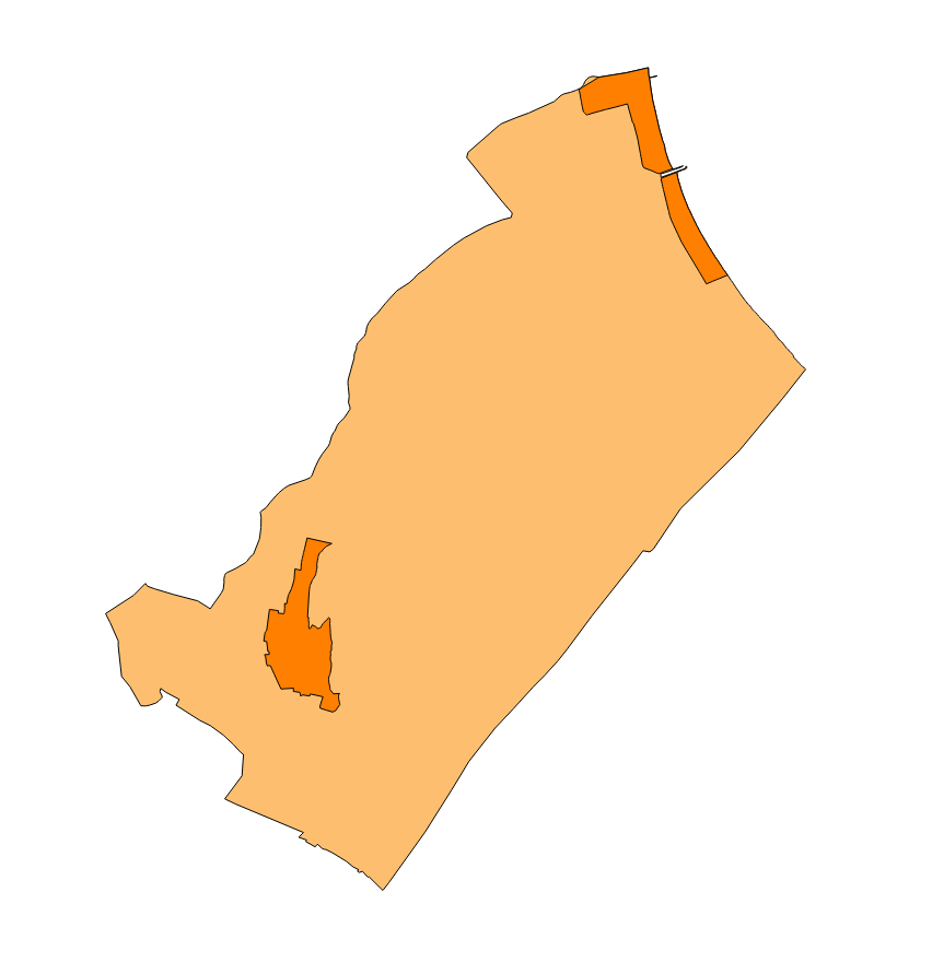
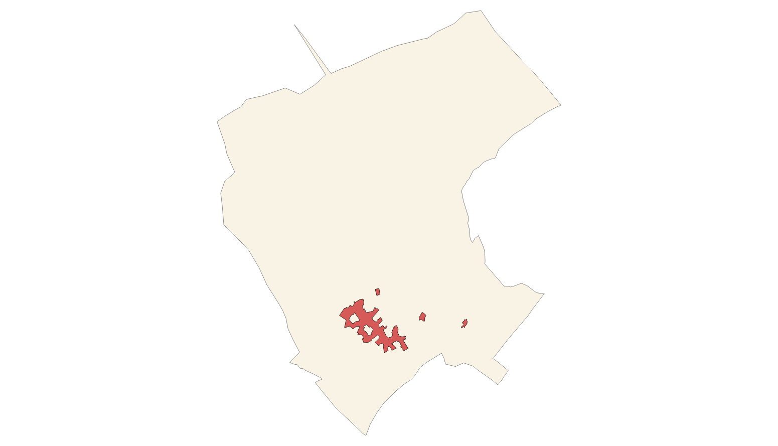
Data set containing the management areas of the municipality of Arta. The cartography was taken from the Arta Subsidiary Standards of 2015. The AM.Forest layer is a polygon layer and contains managed, restricted, or regulated forest areas that follow the INSPIRE data model. The AM.ProspectingAndMiningArea layer is a polygon layer and contains managed, restricted, or regulated prospecting areas that follow the INSPIRE data model. Scale 1: 5,000. The reference system: ETRS89. Projection system: UTM zone 31. Storage format: PostgreSQL.
-
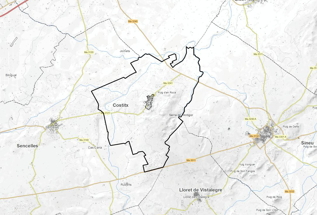
Data set containing the management areas of the municipality of Costitx. The cartography was taken from the Adaptation of Costitx Subsidiary Standards of 2017 to the Territorial Plan. The ForestManagementArea layer is a polygon layer and contains managed, restricted, or regulated forest areas that follow the INSPIRE data model. Scale 1: 5,000. The reference system: ETRS89. Projection system: UTM zone 31. Storage format: PostgreSQL.
-
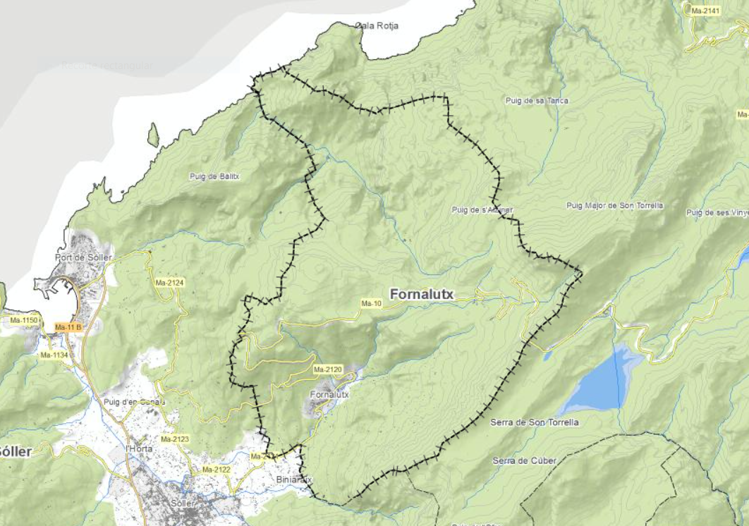
Data set containing the management areas of the municipality of Fornalutx. The cartography was taken from the subsidiary regulations of Fornalutx of 2006. The AM.ForestManagementArea layer is a polygon layer and contains managed, restricted, or regulated forest areas that follow the INSPIRE data model. Scale 1: 5,000. The reference system: ETRS89. Projection system: UTM zone 31. Storage format: PostgreSQL.